• Hi Guest!

    The costs of running this forum are covered by Sea Lion Press. If you'd like to help support the company and the forum, visit patreon.com/sealionpress

Imperial Parliament STV Constituencies

Glad to see this back. I always love those ridiculous diagonal Quebec borders.
River frontage borders are very common throughout the American West - what makes Quebec weird is that their ones are based on lines directly perpendicular to the river instead of compass points.

That's the seigneurial system for you - it does weird things to geography, to the point where if you look at satellite imagery on Google Maps, as the OP mentioned you see a preponderance of very long and thin areas because those were the closest access points to river transport (the highways of their day). To make it make sense, one would have to see Québec's geography as they themselves saw it, which is why during the French colonial period and even for a long time after you see a preponderance of maps where the St. Lawrence is a central rectangle and from there all the seigneuries, towns, etch. etch. look "normal" and, well, American. As @OwenM noted, everything is all relative to the St. Lawrence which makes sense because that was the main artery of traffic in colonial days, and still is to this day despite the convenience of cars, airplanes, and what not.

Having said that, even to this day the St. Lawrence forces some adjustment to big projects - take the autoroutes, for example. Autoroutes parallel to the St. Lawrence are considered east-west routes (even though more accurately it would be northeast to southwest), while autoroutes perpindicular to the St. Lawrence are considered north-south routes (again, even though more accurately it would be northwest to southeast); only Autoroutes 5 and 70 really get with the program, and that's because they are generally isolated from the rest of the Montréal and Québec City-centric network.
 
Thanks everyone for the positive responses to the latest update!

If you'd want something more crazy - here's the Senatorial districts for Québec, as mandated by the Constitution. As one can imagine, they haven't changed much since.
I thought about trying to base a map on the Senate lines instead of the Commons lines, but my abortive efforts got ugly fast. Then I decided it would be better to be consistent anyway.

Glad to see this back. I always love those ridiculous diagonal Quebec borders.
They're a thing of beauty, yes, although at least Canadian boundaries tend to be contiguous, England. (Granted, Britain is a paragon of congruity compared to the Continent.)

I have a basemap of the British Isles at about the right scale, which you can use if you like - I can’t get at it for a few hours, it’s midday here, but let me know and I’ll tidy it up and post it.
I would be honoured and delighted if you would be so good as to share the map, thank you very much!

As prelude, let's talk about England (remembering that the lines are those of the 1889-1965 administrative counties):

The following counties have already been mapped:

London (60).

The following counties are entitled to seven or fewer MIPs and will thus be at-large county constituencies:

Bedfordshire (2), Berkshire (3), Buckinghamshire (3), Cambridgeshire + Isle of Ely (3), Cornwall (4), Cumberland (4), Dorset (3), Herefordshire (1), Hertfordshire (3), Huntingdonshire (1), Leicestershire (6), Lincolnshire (Holland + Kesteven + Lindsay) (6), Norfolk (6), Northamptonshire + Peterborough (4), Nottinghamshire (7), Oxfordshire (2), Rutland (1, and that is with my finger pushing down so hard on the scale that it's broken), Shropshire (3), Somerset (6), Suffolk East + West (5), Westmorland (1), Wiltshire (4), Worcestershire (6), the East Riding of Yorkshire (5), and the North Riding of Yorkshire (5). Sussex in its entirety is entitled to 8 constituencies, so I'll probably keep it separated into East Sussex (6) and West Sussex (2) to avoid having to divide it some other way.

The following counties are entitled to eight or more MIPs and thus must be split into multiple constituencies:
Cheshire (11), Durham (16), Essex (14), Gloucestershire (9), Hampshire (10), Kent (13), Lancashire (58), Middlesex (11), Northumberland (8), Staffordshire (16), Surrey (25), Warwickshire (12), and the West Riding of Yorkshire (37). Several of these are dominated by a single large city which (possibly along with its environs) can form a three-member constituency of its own, but not all of them.

And then there's the City of York (1), which naturally doesn't belong to any of the three ridings and I imagine would chafe tremendously at being lumped into one over the other two. @Thande, I'm going to have to keep it an independent one-member constituency, aren't I? Lest we have the biggest popular uprising in Yorkshire since 1536, anyway...
 
Last edited:
I would be honoured and delighted if you would be so good as to share the map, thank you very much!
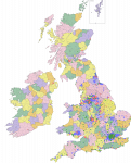
Here it goes then. These are 1898 boundaries on the island of Ireland, so that should be fine. Scotland and Wales are in their 1947 boundaries, and England is allegedly 1931 but anachronistic for that date (@Alex Richards has details on that).

3EB-full.png
 
Also, I’d try to separate out any county boroughs big enough to form their own constituencies, since they were administratively separate from the counties that surrounded them. Even in counties small enough to form single constituencies - though the only one that’s likely to apply to is Nottingham.
 
The Derbyshire split's been done as well of course.

Oh and do not get me started on the inaccuracies of the 1931 English Districts map. Every time I do more research I find another error.

EDIT: Oh and the Soke of Peterborough was traditionally associated with Northamptonshire at this point, not sure how that complicates things wrt Huntingdonshire.
 
Last edited:
Here it goes then. These are 1898 boundaries on the island of Ireland, so that should be fine. Scotland and Wales are in their 1947 boundaries, and England is allegedly 1931 but anachronistic for that date (@Alex Richards has details on that).
Thank you very much - that is a beautiful map and I will do my best to find and compare it against county-level maps which purport to be more accurate to the turn of the century.

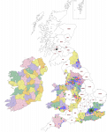
And because I inhabit the borderline space between "compulsively helpful" and "control freak", have a version with the English counties you list above and the Scottish divisions previously made:

I would add the Welsh and Irish ones too, but it's 2am here and even I have limits.
Thank you so much! I'm totally blown away. Please feel free to continue with your compulsive helpfulness!

Also, I’d try to separate out any county boroughs big enough to form their own constituencies, since they were administratively separate from the counties that surrounded them. Even in counties small enough to form single constituencies - though the only one that’s likely to apply to is Nottingham.
Agreed - wholeheartedly. These are:

Leicestershire, which is divided into the town of Leicester, with a population of 225,911 (3 MIPs) and the remaining county of Leicestershire, with a population of 211,579 (3 MIPs). The town of Leicester was an early stronghold for the Labour Party, with future PM Ramsay MacDonald winning one of the two seats there in 1906 (one of just 29 Labour victories in the whole UK), and it is thus extremely likely that one of the three MIPs to be elected there in the first Imperial election will also be Labour.

Nottinghamshire, which is divided into the city of Nottingham, with a population of 239,743 (3 MIPs) and the remaining county of Nottinghamshire, with a population of 274,716 (4 MIPs).

Gloucestershire, which is divided into the city of Bristol, with a population of 328,945 (4 MIPs) and the remaining county of Gloucestershire, with a population of 305,784 (4 MIPs).

Northumberland, which is divided into the city of Newcastle-upon-Tyne, with a population of 215,328 (3 MIPs) and the remaining county of Northumberland, with a population of 387,791 (5 MIPs). One of the two seats in Newcastle-upon-Tyne was another to be won by Labour in 1906, so one of the three MIPs will almost certainly be Labour at the first Imperial election.

Warwickshire, which is divided into the city of Birmingham, with a population of 522,204 (7 MIPs) and the remaining county of Warwickshire, with a population of 417,700 (5 MIPs). Although Labour didn't do nearly as well in Birmingham as might be expected prior to WWI despite the city's great size and industry (probably because it was a Chamberlain and Liberal Unionist fiefdom), they still nearly won Birmingham East in 1906 and also got a third of the vote in Birmingham Bordesley that same year. (Better than they did in Birmingham in either 1910 election, believe it or not!) Therefore, one of the seven MIPs is likely to represent Labour at the first Imperial election, alongside at least one and probably two Chamberlains (Neville is more domestically-minded, he can stay in the English Commons) and any number of other Liberals and Unionists in the other four seats.

This leaves the following counties which need to be divided more precisely: Cheshire (11), Durham (16), Essex (14), Hampshire (10), Kent (13), Lancashire (58), Middlesex (11), Staffordshire (16), Surrey (25), and the West Riding of Yorkshire (37).

The Derbyshire split's been done as well of course.
Indeed it was, thank you again for that.

Alex Richards said:
Oh and do not get me started on the inaccuracies of the 1931 English Districts map. Every time I do more research I find another error.
They're thin on the ground, but wherever I can find more contemporary maps I plan to use them. It really depends on the county. Lots of great maps of Warwickshire and now Essex but other counties are very difficult to map correctly.

Alex Richards said:
EDIT: Oh and the Soke of Peterborough was traditionally associated with Northamptonshire at this point, not sure how that complicates things wrt Huntingdonshire.
That's what I get for accidentally looking at the 1965-74 map first. Thank you very much for the correction, it has been noted and logged.

The Only Way Is Essex, which will be the subject of my next boundaries map, as I've found maps of contemporary divisions which I can use as a basis for the lines. You might well say I'm an Essex Man. You can expect that sometime soon.
 
Last edited:
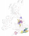
Alright, here's the current state of play. I divided Glamorgan according to 1885 constituency boundaries, so I don't know what the populations would be exactly (the 1885 boundary review was based on Sessional Divisions, i.e. the local court districts that existed before the Local Government Acts, so you're unlikely to be able to find data for those in 1901), but your estimate of four seats each for Swansea and Cardiff and another three for Merthyr doesn't sound off.

Another thing I pilfered from my 1885 map was the outer boundaries of those Parliamentary Boroughs large enough to form their own constituencies here. Some of these cities may since have been expanded - I'm unsure about Glasgow in particular.

brainbin-stv.png

EDIT: Added Derbyshire seats courtesy of @Alex Richards.
 
Last edited:
You could resolve the Hunts-Peterborough situation by merging Huntingdonshire and Bedfordshire. They ought to produce a comfortable three-seater put together, and I don't think the combination is that outlandish.

(Also, Rutland can probably be merged with Leics - the fact that Leicester itself isn't part of it should make them slightly more amenable to it)
 
Alright, here's the current state of play. I divided Glamorgan according to 1885 constituency boundaries, so I don't know what the populations would be exactly (the 1885 boundary review was based on Sessional Divisions, i.e. the local court districts that existed before the Local Government Acts, so you're unlikely to be able to find data for those in 1901), but your estimate of four seats each for Swansea and Cardiff and another three for Merthyr doesn't sound off.
More excellent work! Thank you so much, the UK is really starting to come together nicely. However, Peterborough is still attached to Huntingdonshire when it should be attached to Northamptonshire. As it happens I did find what appears to be contemporary district maps of Glamorganshire (the source says the map is from 1880 but it has the 1885 Parliamentary constituencies overlaid so they're clearly mistaken). At some point I'll see if I can do a Thorough Analysis. Want to finish Essex first. The Only Way Is Essex!

Ares96 said:
Another thing I pilfered from my 1885 map was the outer boundaries of those Parliamentary Boroughs large enough to form their own constituencies here. Some of these cities may since have been expanded - I'm unsure about Glasgow in particular.
Glasgow is definitely larger c. 1910, as it expanded twice in the first decade of the twentieth century alone. As near as I can tell, Glasgow had an outline that looked like this in 1918, and I imagine it looked much the same c. 1910:

1918-1949_Glasgow_Camlachie.png


You could resolve the Hunts-Peterborough situation by merging Huntingdonshire and Bedfordshire. They ought to produce a comfortable three-seater put together, and I don't think the combination is that outlandish.
But merging Huntingdonshire and Bedfordshire is totally without precedent. This isn't a Labour Government in the 1970s, you know :p

Ares96 said:
(Also, Rutland can probably be merged with Leics - the fact that Leicester itself isn't part of it should make them slightly more amenable to it)
Now there were maps in the late nineteenth century that lumped Rutland in with Leicestershire, presumably because of the county's small land area in addition to its small population. So it wouldn't be outlandish. Still, merging Rutland into Leicestershire creates a dangerous precedent.

Let's Talk About Essex, baby! (Not the first Salt-N-Pepa pun I've ever done, either.)

The problem with Essex is that it underwent truly explosive population growth in the second half of the nineteenth century, which continued into the twentieth. The entire southwestern corner of the historical (and administrative) county of Essex is now part of Greater London IOTL, and for good reason. It's so dense, every single district has so many people going on. To address this situation, let's return to the Guidelines:

  1. Can the entire county comprise a single constituency with 7 MIPs or less?
    No, Essex will return 14 MIPs. There must be at least one division.
  2. How many constituencies can be formed within the county?
    Four - 14 divided by 3 is 4.66..., rounded down is four.
  3. Can the largest settlement within the county comprise a constituency with 3 or more MIPs?
    Yes, the County Borough of West Ham would form a constituency which would return 3 MIPs.
  4. Can the remainder of the county comprise a single constituency with 7 MIPs or less?
    No, the remainder of Essex will return 11 MIPs. There must be at least one division.
  5. How many constituencies can be formed within the remainder of the county?
    Three - 11 divided by 3 is 3.66..., rounded down is three.
  6. Can the largest remaining settlement within the county comprise a constituency with 3 or more MIPs?
    No, the urban district of Leyton would form a constituency which would return only 1 MIP.
  7. When did the remainder of the county last have the number of constituencies equal to or less than the maximum?
    Never - Essex had four constituencies before 1832 and at least that many ever since.
  8. Were any of those constituencies a borough constituency insufficiently populous to form an Assembly Constituency?
    Yes - Colchester, Harwich, and Maldon.
  9. When did the county last have the number of constituencies equal to or less than the maximum, plus enough to account for the borough constituencies?
    From 1868 to 1885 - three constituencies. (North West Essex, North East Essex, and South Essex.)
  10. Did any constituencies completely surround or abut the borough constituencies?
    Yes - North East Essex surrounds all three borough constituencies.
  11. Then add the borough constituencies to the abutting constituency. Does this create the maximum number of constituencies, each with no more than seven but no less than three MIPs?
    There's the rub.
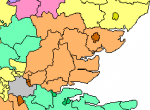
This is our problem. Here is a map of the 1868-85 lines in Essex.

BoundComm%201868.JPG


More than half the population of Essex in 1901 is in the westernmost third, I would say, of South Essex. Well over half a million people, probably about 600,000 all told. I'm not sure either of the other two constituencies can reach 3 MIPs on their own. For all that North East Essex has the three ancient boroughs, adding all of them together barely gets you to 1 MIP, and that's after rounding up. (But there are still more people than in Rutland, so kudos to them.) In order to square this demographic conundrum with my attempt to pay homage to historical boundaries, I might keep 1868-85 South Essex in place and combine the two northern Essex constituencies into an "all-the-rest" North Essex which never actually existed before (the North Essex of 1832-68 was mostly north of the Blackwater), and which may struggle to crack 3-4 MIPs... honestly as long as it does manage four against the maximum seven of South Essex it may have to do. I certainly can't use 1832-68 South Essex as that would almost certainly be too populous, although if somehow it weren't, I'd be obliged to. I have more pondering to do... as always, I welcome everyone's input!

(N.B. For all that I'm playing along with the mockery of Essex, I must give it due - it has historians who truly care. There's a brilliant website called oldessexmaps.co.uk which is every cartographer's dream, and my source for the 1901 census data is a site maintained by the University of Essex. A very heartfelt cheers, mates!)

 
More excellent work! Thank you so much, the UK is really starting to come together nicely. However, Peterborough is still attached to Huntingdonshire when it should be attached to Northamptonshire. As it happens I did find what appears to be contemporary district maps of Glamorganshire (the source says the map is from 1880 but it has the 1885 Parliamentary constituencies overlaid so they're clearly mistaken). At some point I'll see if I can do a Thorough Analysis. Want to finish Essex first. The Only Way Is Essex!

Glasgow is definitely larger c. 1910, as it expanded twice in the first decade of the twentieth century alone. As near as I can tell, Glasgow had an outline that looked like this in 1918, and I imagine it looked much the same c. 1910:

1918-1949_Glasgow_Camlachie.png


But merging Huntingdonshire and Bedfordshire is totally without precedent. This isn't a Labour Government in the 1970s, you know :p

Now there were maps in the late nineteenth century that lumped Rutland in with Leicestershire, presumably because of the county's small land area in addition to its small population. So it wouldn't be outlandish. Still, merging Rutland into Leicestershire creates a dangerous precedent.

Let's Talk About Essex, baby! (Not the first Salt-N-Pepa pun I've ever done, either.)

The problem with Essex is that it underwent truly explosive population growth in the second half of the nineteenth century, which continued into the twentieth. The entire southwestern corner of the historical (and administrative) county of Essex is now part of Greater London IOTL, and for good reason. It's so dense, every single district has so many people going on. To address this situation, let's return to the Guidelines:

  1. Can the entire county comprise a single constituency with 7 MIPs or less?
    No, Essex will return 14 MIPs. There must be at least one division.
  2. How many constituencies can be formed within the county?
    Four - 14 divided by 3 is 4.66..., rounded down is four.
  3. Can the largest settlement within the county comprise a constituency with 3 or more MIPs?
    Yes, the County Borough of West Ham would form a constituency which would return 3 MIPs.
  4. Can the remainder of the county comprise a single constituency with 7 MIPs or less?
    No, the remainder of Essex will return 11 MIPs. There must be at least one division.
  5. How many constituencies can be formed within the remainder of the county?
    Three - 11 divided by 3 is 3.66..., rounded down is three.
  6. Can the largest remaining settlement within the county comprise a constituency with 3 or more MIPs?
    No, the urban district of Leyton would form a constituency which would return only 1 MIP.
  7. When did the remainder of the county last have the number of constituencies equal to or less than the maximum?
    Never - Essex had four constituencies before 1832 and at least that many ever since.
  8. Were any of those constituencies a borough constituency insufficiently populous to form an Assembly Constituency?
    Yes - Colchester, Harwich, and Maldon.
  9. When did the county last have the number of constituencies equal to or less than the maximum, plus enough to account for the borough constituencies?
    From 1868 to 1885 - three constituencies. (North West Essex, North East Essex, and South Essex.)
  10. Did any constituencies completely surround or abut the borough constituencies?
    Yes - North East Essex surrounds all three borough constituencies.
  11. Then add the borough constituencies to the abutting constituency. Does this create the maximum number of constituencies, each with no more than seven but no less than three MIPs?
    There's the rub.
This is our problem. Here is a map of the 1868-85 lines in Essex.

BoundComm%201868.JPG


More than half the population of Essex in 1901 is in the westernmost third, I would say, of South Essex. Well over half a million people, probably about 600,000 all told. I'm not sure either of the other two constituencies can reach 3 MIPs on their own. For all that North East Essex has the three ancient boroughs, adding all of them together barely gets you to 1 MIP, and that's after rounding up. (But there are still more people than in Rutland, so kudos to them.) In order to square this demographic conundrum with my attempt to pay homage to historical boundaries, I might keep 1868-85 South Essex in place and combine the two northern Essex constituencies into an "all-the-rest" North Essex which never actually existed before (the North Essex of 1832-68 was mostly north of the Blackwater), and which may struggle to crack 3-4 MIPs... honestly as long as it does manage four against the maximum seven of South Essex it may have to do. I certainly can't use 1832-68 South Essex as that would almost certainly be too populous, although if somehow it weren't, I'd be obliged to. I have more pondering to do... as always, I welcome everyone's input!

(N.B. For all that I'm playing along with the mockery of Essex, I must give it due - it has historians who truly care. There's a brilliant website called oldessexmaps.co.uk which is every cartographer's dream, and my source for the 1901 census data is a site maintained by the University of Essex. A very heartfelt cheers, mates!)
Maybe I'm misunderstanding, but could you do something by combining the OTL 1885 parliamentary constituencies there, European Parliament Classic style?

1553682024331.png
 
Maybe I'm misunderstanding, but could you do something by combining the OTL 1885 parliamentary constituencies there, European Parliament Classic style?

View attachment 9714

I could. I might have to, although I'll see if I can do some recalculations based on successive censuses with the different boundary lines.

My theory as to the apportionment is, many of the older guard on the Commission drawing the lines see this as a prime opportunity to re-create how constituencies ought to look - either as whole counties or the boroughs within them. (Never mind that nobody on the Commission was even alive in 1832 and literally cannot remember the Unreformed Parliament.) The problem is, although many counties can form single at-large constituencies of three to seven MIPs, many cannot - they're too populous or not populous enough. So we'll at least try to be as traditional as possible, forming constituencies built on the 1832 lines, or barring that the 1868 lines, or, if we absolutely must, the 1885 lines. (I'd imagine that, concurrently to the Imperial lines being drawn, new English/Scottish/Irish Parliamentary lines are being drawn as well, a few years ahead of schedule.)
I more just meant that the 1885 lines might give you a clearer idea of rough population distribution - although of course there was still a huge variation in constituency size at this time.
 
Back
Top