• Hi Guest!

    The costs of running this forum are covered by Sea Lion Press. If you'd like to help support the company and the forum, visit patreon.com/sealionpress

Max's election maps and assorted others

I am going to have to use letter marks for quite a few of these constituencies - particularly in Bohemia, where the indigo stands for, by any definition, at least three separate parties. However, there’s a very good reason why I decided to show the constituency numbers instead of drawing connecting lines between all the detached parts of every constituency, and I might have to go back on that if I’m going to have any way to disambiguate.

Yeah, I’m starting to see why no one’s really tried to do this since Austria-Hungary disappeared.
 
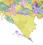
Okay, so somehow, Dalmatia has ended up being the last thing I've gotten to. Specifically it's the mainland that's giving me trouble, because while the islands are annoying to draw, they are pretty easy to sort into districts. I've had no luck finding either a good map or a thorough description of the mainland districts, although I may end up having another trawl to see if I can find some modern-day maps of Croatian municipalities I could work off of.

1667693138188.png
 
Austria-Hungary 1914 (K)
It's done.

osterreich-bezirke-1914.png


I don't have the language map done yet (because I can't find any information about the district-level makeup of Croatia-Slavonia, the Hungarian census books only have them by county and municipality for some reason), but here are the electoral constituencies.

reichsrat.png

What I have found is a constituency map (though not a very good one) of Croatia, so I might map some of those elections as a special treat. And because I still can't find a good map or description of the Hungarian parliament's constituencies.
 
Okay, so I decided there was simply no way on earth to accommodate all the different political parties with our standard shades, and so rather than oversimplify a system that I really don't think is done justice if you don't get a headache trying to parse it (much like this sentence, amirite?), I decided to split it up into a number of separate maps with separate keys depicting the different parts of the empire. Before this is done, there's going to be at least one more - of Galicia, which is fair enough given I'll need to show that three separate times - and I'll probably have to do an inset for Dalmatia as well, especially if I want to be able to distinguish the political parties there in any way whatsoever.

View attachment val-at-1907.png

Oh, and if anyone reading this speaks Czech, please feel free to correct those parts of the key.

EDIT: There’s a bunch of colouring errors still left on this, rest assured that they will be fixed before the next upload.
 
Last edited:
Okay, so I've now gone through the Galician results in the official statistics, and I think (emphasis on "think") this is how the electoral system worked there:

- The kingdom is divided into 70 constituencies, of which 34 are urban constituencies electing one member each and the remaining 36 are rural constituencies electing two members each (thus totalling 106 representatives in the Reichsrat for Galicia). For the urban constituencies, the election is carried out under exactly the same system as in the other provinces.
- In the rural constituencies, even though two seats are up for election, the voter only casts a single (non-transferable) vote. This is done in order to prevent the ethnic majority from crowding out the largest minority.
- Once the votes are tallied, if the first-placed candidate has reached 50% of the vote, that person is declared elected.
- If the first-placed candidate reached 50% of the vote and the second-placed candidate reached 25% of the vote, they are both declared elected and the election is complete.
- If the first-placed candidate reached 50% of the vote, but no other candidate reached 25%, there is a runoff between the second- and third-placed candidates to determine who wins the second seat.
- If no candidate reached 50%, the entire election is thrown out and a second round held in which any candidate from the first round may stand again. I don't know if it was possible to nominate candidates for the second round who didn't stand in the first, but my gut says no given that I haven't seen any case where this happened (as far as I've been able to determine - the statistics don't name individual candidates, but do show multiple candidates from the same party separately).
- The win conditions for the second round are the same as in the first round (50% for the first-placed candidate and 25% for the second), but if no one wins 50% this time either, a runoff is held with the top three candidates, of which the top two are declared elected.

Really, this is one of those cases where the word "insane" doesn't quite feel like enough. As mentioned earlier, the object of this system was to provide representation for the ethnic minority in mixed areas, and even the statistical manual explicitly notes that the constituencies where this was relevant tended to be the ones where Ukrainians formed the majority and Poles the minority. So in practice, it wasn't so much that it would be too much of a pain to draw fair constituencies, as it was that the Polish nobles who ran the Galician Diet felt that they deserved to maintain control even though the electoral system no longer favoured them quite as blatantly as the previous one had.
 
There is actually one thing I'll say in favour of this mad system, which is that it could counter one particular problem with SNTV. If a party was exceptionally popular in a given area, stood two candidates, and one of them got through in the first round, their voters could then vote a second time for the party's other candidate provided they got through to the runoff. Which, granted, does depend on that second candidate getting less than 25% while placing at least third and having no other candidate get more than 25%, so I don't know if it really solves that problem in a more elegant way than STV would.
 
Honestly, this is absolutely worth putting on Wikipedia (with a revamp on the section on the electoral system).

Just amazing.
Second this. I've never quite seen anything like it, and there are some really dedicated mappers on Wiki. And there is really not much on there from this era, let alone in this kind of intricate detail.

Honestly, most of your content is worth exposing to a wider audience!
 
It's interesting to see the Sudetenland bathed in red.

I mean it's the more natural politics for the area considering it was a big centre of industry and mining.

I can very easily see a flip of what happened historically in a surviving Austria-Hungary (or Austria-Bohemia if Galicia and Hungary are gone) where the German speaking areas have a clearly defined 'normal' politics of socialists vs. Agrarians with some minor parties on the edges while the Czech areas just end up with some big catch-all Nationalist party dominating equally well in areas of heavy industry and extremely rural farming areas.
 
Back
Top