• Hi Guest!

    The costs of running this forum are covered by Sea Lion Press. If you'd like to help support the company and the forum, visit patreon.com/sealionpress

Max's election maps and assorted others

OGR: Fourth Party System
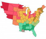
  • The Fourth Party System of the American Republic lasted from about 1880, when the ten-year period of gradual emancipation ended (a few "grandfathered" slaves continued to exist in the Deep Southern departments into the 20th century), until the rise of class-based parties in the 1900s and 1910s. The similarity between the party landscapes of the Third and Fourth systems (the only major change being the renaming of the Free Soil Party to the Radical Party) has led some political scientists to group the two together, but this is a minority view, and ignores the seismic shift in American society caused by the end of slavery. Treasurers Adams and Harrison attempted to secure the social and political rights of the freedmen, and while these efforts met with limited success generally, increased electoral scrutiny meant that Black Americans did gain, and avail themselves of, the right to vote to a great extent.

    The Federalists remained the dominant party, as they had in all previous systems except the Second. Their strength was based primarily in the Northeast, whose major cities had developed patron-client networks that ensured immigrants and native-born workers stayed in the Federalist fold. The Radicals penetrated smaller industrial cities, but New York, Boston and Philadelphia sent majority-Federalist delegations to the National Assembly throughout the era. The farmers of the Midlands and Appalachia also continued voting Federalist, and with the urban machines and the old-line Yankees of New England created a three-part alliance that proved to contain a strong majority of the electorate.

    The main opposition throughout the Fourth Party System were the Radicals. Ben Wade had transformed a broad-church, single-issue anti-slavery party into a coherent vehicle of the centre-left, and sent a few more conservative Free Soilers over to the Federalists in the process. But the new party also gained voters and talent from formerly unrepresented sections of American society. Chiefly, the Radicals would draw on the West for support - the Great Plains departments voted for them by large majorities in most elections, as did the industrial region around the Great Lakes. The Radicals were beginning to crack the Eastern cities by the turn of the 20th century, but it was only with the rise of Labor that the change really came.

    Rural America, then, was the major battleground between the two parties. The Midlands, New England and Appalachia leaned Federalist, the Plains leaned Radical, and the upper Midwest, the Southwest and the rural Mid-Atlantic were swing regions. The need to win rural votes benefitted many of these regions, as agricultural subsidies, seed benefits, rural mail delivery and the National Railroad were all brought into place in the 1890s.

    The South differed from the rest of the nation, as ever, because the Patriot Party still lingered there. Alexander Stephens had kept the party alive in his home region, and Wade Hampton and Ben Tillman continued the pattern. They dropped official support for the institution of slavery in the late 1880s, but remained committed to white supremacy throughout the era - as were most southern Federalists, for that matter. The "Cotton Belt" tended to be more inclined toward the Patriots and the Upper South toward the Federalists, but this was far from consistent and the entire region could swing from one party to the other based on individual candidates.

    The Black population tended to vote Federalist, grudgingly, but because they were only the majority in a few Assembly divisions, their main source of influence was as a swing vote. The Radicals attempted to campaign in majority-Black districts in the 1890s and 1900s, but poor local organization meant they met limited success.

    The electoral geography of the Republic saw its biggest shake-up ever in 1896, when Adlai Stevenson's "wedding-cake plan" of layered local government came into effect. Twenty provinces became 65 departments (and the city of New York, which was and is outside the system), and the entire legislative and electoral apparatus was reformed to fit the new borders. The size of the National Assembly (400) and the Electoral Assembly (250) were fixed at their current numbers, and single-member divisions for the former were drawn to be as equal in population as reasonably possible. Departmental general councils gave the Radicals and Patriots an institutional base, and the dual oversight of general council officials and prefect's offices extinguished many of the corrupt practices of the old provincial administrations. This seismic shift in how the Republic operated, along with the increasing class consciousness of workers and farmers, laid the foundations for the Fifth Party System, the most fractious in American history.
    hamiltonverse-parties-4.png
     
    Last edited:
    OGR: Electoral College
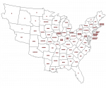
  • To give an idea of how big these departments are, here's the first post-Stevenson Plan apportionment for the Electoral College.

    hamiltonverse-electors-1900.png

    Under the original system, the number of electors given to each province was based on a regional quota system similar to the OTL Canadian Senate, but the Stevenson Plan changes this so that each department is guaranteed one elector and the rest are distributed by population. The electors are chosen by bloc vote, and unlike the National Assembly, the franchise is still restricted to landowning men. This means the electorate is about half of adult males, disproportionately rural and just about entirely white (though it's not an explicitly racist franchise anymore).

    The way the Electoral College works sort of resembles the sénat conservateur of Imperial France, or at least there's not really a closer OTL analogy. The electors are expected to be on call in New York for most of the year, and when a senator dies or resigns, the electors from his (or her, in very theoretical theory) home department nominate a successor with the advice and consent of the general council. The proposed successor gets voted on by all the electors, requiring a two-thirds majority to be approved, and if this is not reached, a new candidate must be nominated. The process is repeated until a two-thirds majority is found, at which point the candidate approved is seated as a Senator in the subsequent session. There are about a hundred senators at any given time, quite a few of them very old, so electoring is more time-consuming work than you'd expect from a short job description.

    The Supreme Governor is chosen in a similar way, except that instead of being nominated by departmental electors, he's (again, there's nothing explicitly saying a woman can't serve, but hahahahahahahahahahahahaha oh God have you seen the 19th century) nominated by the National Assembly. Any candidate who gets signatures from more than one-fifth of the Assembly is nominated and proceeds to the Electoral College, which, as before, needs to approve a candidate by a two-thirds majority.

    As you can tell, this isn't a very democratic or efficient way to run a government (have I mentioned that senators and the Supreme Governor serve for life?). Which is what happens when you mix Alexander Hamilton's plan of government with state governments fighting tooth-and-nail for what few powers they have left.
     
    Norway 1973
  • Decided less ancient maps are probably going to be more accessible, so with that in mind I'm skipping the Norway series ahead to the point where the SSB start providing percentage results by municipality (which happily coincides with one of the most chaotic periods in their recent political history). This is going up on the DA as soon as I have the time and energy to write it up.

    Storting 1973

    val-no-1973.png
     
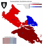
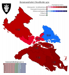
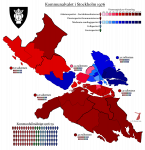
    Stockholm 1962/1970/1976
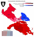
  • The prequel, 1962, held during one of those brief, weird interludes in history where Stockholm had council constituencies drawn by a perfectly sane person:

    val-1962-sthlm.png

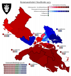
    The filler, 1970, the first election held after the municipal reform (and also the last not to have parish-level data - I wish these aligned better, but alas):

    val-1970-sthlm.png

    And 1976, the first election held on more or less the boundaries used today:

    val-1976-sthlm.png
     
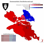
    Stockholm 1946
  • And one of the earlier ones I got the data for: 1946.

    val-1946-sthlm.png

    This remains the best result ever for a party to the left of the Social Democrats in Stockholm. Also one of the better ones for the combined left, although the 30s and 40s were left-wing times, so for the period it's perfectly average.
     
    ATP 1957 (Stockholm)
  • These statistical yearbooks turn up all sorts of weird side details. The 1958 one has a full results table, including percentages, for the 1957 supplementary pension referendum.

    Now, in tried and tested Swedish fashion, the referendum was called because the coalition government couldn't agree among themselves, and in tried and tested Swedish fashion, it went far beyond anything so crude as a yes-no. Instead it had three options listed on the ballot. Line 1, supported by the Social Democrats and Communists, called for a universal right to supplementary pensions for all employees, with non-employees able to sign up to voluntary pensions whose value would be guaranteed by the state. Line 2, supported by the Agrarians, called for the system of voluntary guaranteed pensions to apply to everyone, while line 3, supported by the Liberals and Conservatives, rejected the idea of a state guarantee entirely and called for pensions to be agreed upon by the parties in the labour market and supported by legislation without a formal guarantee. Got that?

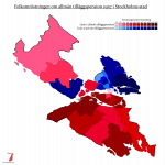
    Well, in fairness, neither did most of the voters. Most of them voted on party lines, so I've marked Line 1 in red and Line 3 in blue on the map. Line 2 didn't win anywhere in Stockholm, but I'd depict it in green if it had won anywhere.

    ref-1957-sthlm.png

    As you can see, this basically aligns with bloc strength - it is sort of an interesting map insofar as we can see how a united right would look on the map. The Liberal vote being added to the blue total means we can tell the middle-class bits of Söderort apart from the properly proletarian bits, and Norrmalm goes from swingy on the ordinary maps to a solid blue. There is the obvious caveat that about 10% of Stockholmers voted for the Agrarian line, a number the actual party would never reach in the capital.

    The nationwide result was 46% for Line 1 (whose supporters claimed victory because their line got the most votes), 35% for Line 3 (whose supporters claimed victory because Line 1, the only line calling for state control, hadn't gotten a majority) and 15% for Line 2 (whose supporters claimed "victory" because their line got half again as many votes as the Agrarians had gotten in the 1956 general election). The Agrarians left the cabinet, unable to work with a party they'd opposed in the referendum campaign, and Erlander's new minority government tabled a motion to introduce mandatory state pensions, which was narrowly rejected by the Second Chamber. The result was the most recent snap election in Swedish history, held in June 1958, which resulted in the socialist bloc getting a 116-115 majority. The Speaker was a Social Democrat, which nullified the majority, but the bill nevertheless passed when a Liberal member abstained (which almost immediately got him deselected and removed from his various party jobs).
     
    Hedmark 1975 (R)
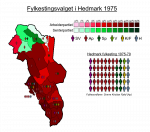
  • Bit of a test here - I mentioned the insane Norwegian county council election system in the other thread last night, and so I thought I'd make a sample map to see if anything can be gleaned about how seat distribution works.

    I think the only thing I have gleaned is that it clearly has nothing to do with municipal-level results.

    val-no-f-1975-hedmark.png
     
    SVFI: ”Två världar”
  • Två världar var en serie fjärrsynssändningar som gick ut från Svenska Rundradion åren 1966-1970. Serien utspelar sig i och kring Åbo under åren 1895-1925, och följer två familjer - en från stadens högsta societet, och en från arbetareklassen - genom denna tumultfyllda tid i Sveriges historia. Den blev extremt folkkär trots blandad kritikeropinion, och räknas som en av de främsta sändningarna i SR:s historia.

    Serien tar sin början vid 1800-talets slut. Samtidigt som direktör Albert Abraham Carstens, delägare i Åbo handelsbörs, med familj firar att brodern Nils blivit invald i riksdagen för hattarna och äldste sonen Erik Adolf tagit studentexamen, bestämmer sig familjen Seppelä för att överge sitt steniga arrende och flytta in till staden. De får bostad i en hyreskasern vid Aningaistullen, ägd av direktör Carstens, och familjefadern Karl och äldste sonen Gustav får arbete i hamnen medan dottern Lisa blir tjänsteflicka hos hyresvärdens familj. Den första serien om sex avsnitt (sänd 1966, täckande åren 1895-1902) etablerar huvudpersonerna - som utöver de två familjerna består av Carstens affärsrivaler, Erik Adolfs studentkamrater vid Åbo universitet, tjänstefolket hos familjen och Karls och Gustavs krets bland hamnarbetarna. Allihop hör till, och vet sin plats inom, den intrikata samhällspyramid som kännetecknade tidens storstadsliv.

    I den andra serien (sänd 1967, täckande åren 1903-08) skildras hur detta system bryter samman till följd av världskriget. Erik Adolf Carstens och Gustav Seppelä kommer bägge två i armén, men den förre blir stabsofficer tack vare sin utbildning och börd, medan den senare måste ta plats i skyttegravarna. Krigserfarenheterna bidrar till att föra de två unga männen (såväl som deras släkter) ännu längre ifrån varandra politiskt, och i det sista avsnittet deltar Gustav i fredsmyterierna medan Erik Adolf är med och smider planerna bakom Sveaborgskuppen. Även på hemmafronten ställs saker och ting på spets, då Carstens rederi skadas av kriget samtidigt som Karl Seppelä räddar sin familj undan svälten genom att smuggla cigarrer.

    Den tredje serien (sänd 1968) tar sin början våren 1909, då Erik Adolf tar magisterexamen och bestämmer sig för att överge släktföretaget för att istället skriva för Åbo Tidning. Samtidigt ger sig Gustav Seppelä in i politiken, och blir invald i fullmäktige som socialist efter att rösträtten blivit jämkad. Serien slutar 1914, efter ”slaget vid Slottsgatan”, där Gustav deltar vid barrikaderna medan Erik Adolf för skriva sin första ledare till stöd för FVF:s agerande före kravallen.

    I den fjärde serien (sänd 1969, täckande åren 1916-21) fortsätter
     
    France 1815 (boundary changes)
  • Okay, prepare for a lot of France in the coming weeks. I was on holiday in Paris (staying with @Redolegna) all this week, and the day before yesterday we paid a visit to the Archives of the National Assembly, whose surprisingly small record room holds, among many other things, a (nearly) complete archive of electoral statistics going back as far as 1848. I was able to take home digital reproductions of all elections held under the Fourth Republic, as well as the 1936 elections (the last held under the Third Republic) and the very odd Algerian results from 1958 (the first elections held under the Fifth Republic). I also got to copy all of the maps (over 600 pages' worth of them) in Bernard Gaudillère's maginificent atlas of French legislative constituencies, which goes back as far as 1815. Provided I can find party affiliations of members, this means I will theoretically be able to map all those elections, albeit without majority shading.

    So to start us off, here's a relatively easy one: the territorial losses sustained by France after the Hundred Days.

    The original Frankfurt Proposals issued by the Sixth Coalition called for Napoleon to be recognised as ruler of a France whose territories stopped at the Pyrenees in the south, the Alps in the east and the Rhine in the north, the "natural borders" established under the First Republic. Napoleon rejected these terms, believing he could still win the war, and when he was finally defeated in 1814, the terms were much harsher. Louis XVIII was restored as King of France and Navarre, and while much of the Napoleonic government apparatus was kept in place, the territory of France was reduced to essentially its pre-revolutionary extent. However, Louis' attempts to rule with a light, non-alienating hand, as well as Napoleon's great deal of freedom in his Elban exile, backfired when the former Emperor was able to return to Paris and restore the Empire, ruling for another hundred days and waging a campaign that ended in his defeat at Waterloo.

    This time, the gloves well and truly came off. Louis was restored again, but this time Napoleon would be put on a boat to the remote British colony of Saint Helena, and Coalition troops would occupy France to make sure no one tried any funny business (and collect a large indemnity). A few more border regions were also detached, leaving France with more or less its modern border in the north and the border that would hold until 1860 in the southeast.

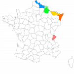
    The departments that lost territory are coloured on the map, with the areas lost in a lighter colour:
    - In red, the department of Mont-Blanc, ceded in its entirety (20 cantons) to the Kingdom of Sardinia.
    - In orange, the department of Bas-Rhin, which ceded four and a half cantons to Bavaria.
    - In yellow, the department of the Moselle, which ceded four cantons to Prussia.
    - In green, the department of the Ardennes, which ceded eight cantons to the Netherlands.
    - In blue, the department of Nord, which ceded three cantons to the Netherlands.

    france-dep-100jours.png
    The atlas includes the constituencies that elected the Chamber of Representatives during the Hundred Days (basically the arrondissements, except in a few places), which is how I found these external borders, and I may go on to map the elections. That's not really my primary focus at the moment though - that's on the Fourth Republic.
     
    France 1951
  • Here it is in all its messy glory.

    France 1951
    val-fr-1951.png

    I have no idea what happened in Algeria between 1946 and 1951 - the actual war conflict emergency situation was still three years away at this point, but I assume there would've been some sort of crackdown on Algerian separatism, because the delegates from there seem to have been in a hurry to stop forming their own party groups.
     
    Last edited:
    France 1791 (constituencies)
  • Well, the 1789 elections may be a headache to map, but the succeeding ones - held in 1791 - are very, very easy. You see, the National Constituent Assembly had been fairly quick to decide that yeah, these administrative divisions are just utterly unsalvageable, aren't they, we should probably put something new in. After the famous brief flirtation with square administrative divisions, they decided to instead adopt a division into 83 departments, very loosely based on the old provinces or divisions thereof, which would be roughly equal in surface area. These would serve as primary local administrative units, court districts, and among many, many subsidiary functions, also electoral divisions for the new Legislative Assembly provided for in the Constitution of 1791.

    The Assembly would be unicameral, which was a fairly radical notion for its time, and its size was fixed at 745. Three seats were fixed to each department, which made up about a third of the total (247). Of the rest, 249 were assigned according to number of active citizens (taxpaying men above 25), and 249 according to the amount of tax paid in the department. While this meant the distribution didn't match population, we can see how much more rural France was at the time - the only cities large enough to skew their departments were Paris (which was of course its own department along with its suburbs - this department would be renamed the Seine in 1795) and Lyon.

    If the administrative division and the working structure of the Assembly were radical for their time, the electoral system was very much not. I mention "active citizens" - well, one of the main things distinguishing them from "passive citizens" was that they got to vote in local elections. The threshold for national elections was even higher, requiring property ownership as well as a higher tax threshold. And even they only elected delegates to a departmental primary assembly, who in turn elected the department's delegates. This was seen as a prudent move by the sort of liberal reformers who ran the Constituent, whose main goals were to ensure good government and prevent mob rule, but the sans-culottes of Paris and the poor peasants of the countryside saw it as a betrayal of the Revolution's ideals. As the months wore on, the Legislative Assembly failed to win much support from anyone, and after provoking a great power war for fun and profit, it would fall like a house of cards in the fateful days of August 1792.

    val-fr-1791.png
     
    Last edited:
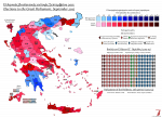
    Greece, June 2012
  • June 2012 makes an interesting compare-and-contrast - of course, while the left/right situation was about the same, the actual gap between ND and SYRIZA was less than three percentage points, so the map ends up a bit redder. Chiefly in Attica, but also noticeably in Macedonia - probably don't need to spell out why they soured on Tsipras between 2012 and 2019.

    val-gr-2012-ii.png
     
    Back
    Top