• Hi Guest!

    The costs of running this forum are covered by Sea Lion Press. If you'd like to help support the company and the forum, visit patreon.com/sealionpress

Caspian's Canister of Creative Works

IcyCaspian

New member
Hello! You may also know me as Juno, but that's not relevant. I've moderated the subreddit r/imaginarymaps for almost 2 years now, and have made a ton of Alternate History graphics in the 3 years I've been active. I've not posted them here before, and I've only posted some of them on discord before. So I'll be posting all of the Alternate History graphics I've made, along with several one-offs here. I'll also be posting future works of mine here. If it's part of a larger timeline, I'll specify that in the post. Same applies if it's just a one-off

I think it's important to note that my main timeline, now called 'She Wins, We Wins', has undergone two major retcons, the first version being called 'Frontrange President', and the second version being called 'A World Awaiting'. I have created content for all three, so just know that it might be from a retconned version of the timeline.
 
Last edited:
Map of the Area formerly constituting the United States, c. 2011 CE
(One-off)

FederatedStatesOfAmerica.png
This was my first serious map, posted on September 30th, 2018. It was originally meant for a contest, but I missed the submission deadline. In terms of its quality, it's not that great of a map, the Everglades for one. But it was my first map, and its special to me because without it, and the helpful advice people gave me at the time, I would not have created many works which are much better.
 
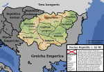
Map of the Dacian Republic, c. 50 BCE
(One-off)

Dacian Republic Map c. 50BC.png
This map was made on November 3rd, 2018. Nearly a month later, but it's a much more in depth map than the one prior, and the difference is massive. For one, this was my first time experimenting with topography and rivers, and this time I actually tried to create a cohesive lore, though granted it isn't great. It was supposed to be in a timeline where the Roman Empire did not exist, but I still was not too great and making timelines at this point, especially for something which I had little knowledge of. However, it was a great improvement from the prior map.
 
Map of the Jagojellian Parliamentary Elections, c. 1495 CE
(One-off)

index.php

This map, originally made December 9th, 2018, was my first experiment with doing an election map. It was alright, not too bad but not great. I also remember that this map was based off of a meme I had seen about the Jagojellian dynasty, and was the first map I made based off of a meme. There would be a lot more of both election graphics and meme graphics after this.
 
Map of the Republic of Indochina, c. 2018 CE
(One-off)

Indochinese_Republic_c.2018.png

This is one of my favorite maps I've ever created. Originally I made it on December 15th, 2018, and I'm really happy with how it turned out. I had gotten an excellent basemap for this, and it was my first attempt at using buckets of lore in the map, though hindsight I should've included something else instead of Approval ratings in the bottom left, but I'm still happy with how it turned out.
 
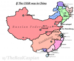
If the USSR was in China
(One-off)

OwOhOk.png
This is yet another example of a meme map, where i tried to make the SSRs of the USSR in the geographical area of China. Not a great map, but the point was to get a quick chuckle so it's alright.
 
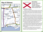
Map of the State of Alabama (c. 2019)
(Gran Lago)

AlabamaGranLago.png

Originally made June 25th, 2019, this was my first experiment with using a map in an atlas/textbook style map, and was meant to be part of a larger atlas for the TL, however my computer crashed 3 different times while making Alaska, and lost a lot of progress on each crash until I eventually lost motivation for the project. I did end up making a cover image and Table of Contents, which I will be posting soon. I should note that this was not for my TL, this was a timeline created by Planita that I created a large amount of graphics for over the month of June.
 
Results of the 2016 Florida Legislative Election
(Gran Lago)


FloridaLegislature.png

This was originally made on June 4th, 2019, and is my first truly good election map. I'm happy with it, even though I'd change a few things if I made it again.
 
Map of the 2016 United States Senate Election in Eureka
(Gran Lago)

EurekaUSSenate.png

This was made the day after the last post, on June 5th, 2019, and was my first time experimenting with fictional counties. It was also, yet again, an election map. You're gonna notice that this becomes a pattern.
 
Map of the 2016 U.S. House election in East Tennessee
(Gran Lago)

EastTennesseeHouseDelegation.png

This map was an attempt at displaying multiple elections in the same infographic, from June 6th, and I think I did a good job with that. However, this map would become out of date because there would be a change that would lead to East Tennessee changing into Appalachia, and absorbing Western North Carolina
 
Map of Californian State Legislative Districts, 2011-present
(Gran Lago)

Californian_Districts.png

This map, which I wouldn't finish until October 28th, 2019, was my first commissioned map. Reason why it was commissioned is because of A. all the other work I had done for the TL, and B. because the creator didn't want to do it themselves. And I can understand why, this took a while to do.
 
Back
Top