• Hi Guest!

    The costs of running this forum are covered by Sea Lion Press. If you'd like to help support the company and the forum, visit patreon.com/sealionpress

Map Commons


This brings to mind Michael Flynn's short story Forest of Time, where the U.S. broke apart after the Revolution, and the various states begin warring constantly warring against and in some cases dividing or swallowing each other. Ex: Virginia and New York are mentioned as having tried to partition New Jersey, but Pennsylvania intervened, leading to the "Piney War."
 
Last edited:
1577562547974.png
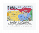
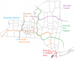
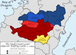
While rereading Arose I started sketching out BNA on a flight of fancy and Oh No! I spent a lot more effort than intended on it.

It is just that - a sketch with some hours thrown at it, so it's pretty basic in a number of ways - but I haven't really tried following exact borders at this sort of scale before & i'm pretty pleased with how it turned out!

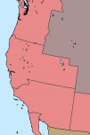
edit: might not be spot on, but here's roughly the arrangement that the california bill proposes for the west coast
1577927342750.png
 
Last edited:
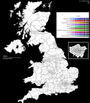
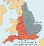
Anyone have a higher quality version of the UK constituency map here? On most versions the borders aren't clearly defined so it makes it hard to fill in.

When I try, it looks like this:

Screenshot 2019-12-30 at 18.45.15.png

(Sorry if this isn't the right thread for this)
 
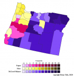
2020 Oregon Secretary of State Democratic primary. I posted a bit about this very close three-way race in the American politics thread, and decided it was worth mapping because of the way the results highlighted the extreme population discrepancies in Oregon: Fagan won despite only carrying five counties, because she came very close in Multnomah County and was in second almost everywhere else. Meanwhile, McLeod-Skinner swept Eastern Oregon, but some of those counties only have a few hundred Democratic primary voters! (Hence the fluky Hass victory in practically-empty Wheeler County.)

Shemia Fagan: 36.23%
Mark Hass: 35.46%
Jamie McLeod-Skinner: 27.55%

SoS 2020 draft.png
 
Someone on my Discord is asking for "good map resources on river and lake systems in Scandinavia." If anyone here knows where I could get access to such things.
 
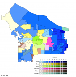
2020 Portland City Commissioner #4 special election

This race was held to succeed the late Commissioner Nick "Yes, One of Those Fishes" Fish. The huge field made the map interestingly geographically fragmented. Here you can see bougie-granola inner Southeast going for green energy lobbyist Tera Hurst, the Lents area going for environmentalist-and East-Portland-localist Julia DeGraw, rich areas going for relatively conservative Sam Chase, and winning candidates Loretta Smith and Dan Ryan splitting the areas without a strong local candidate.

2020 - City Commissioner Position 2.png

Loretta Smith - 18.79%
Dan Ryan - 16.59%

Tera Hurst - 14.81%
Julia DeGraw - 12.64%
Sam Chase - 11.24%
Margot Black - 6.75%
Cynthia Castro - 3.72%
Jack Kerfoot - 3.45%
Other - 12.01%

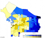
In the runoff, Smith - Generic D, centrist, party insider, lost in a landslide to Jo Ann Hardesty last time she ran for council - and Ryan - relatively unknown school board and nonprofit guy - squared off in a very uninspiring race. Both had platforms full of generic nice things and both were dogged by complaints from former employees. (Smith was supposedly an abusive boss who'd filed frivolous defamation lawsuits against people who complained about her behavior, while Ryan was accused of patronizing liberal racism.) In the end Ryan won by a hair by consolidating votes in inner neighborhoods. Personally I know a lot of people who voted for him despite him being an unknown quantity, simply because they knew and disliked Smith and her behavior in the 2018 race against Hardesty.

2020 - City Commissioner Pos 2 Round 2.png

Dan Ryan - 51.13%
Loretta Smith - 48.10%
 
Last edited:
Back
Top