• Hi Guest!

    The costs of running this forum are covered by Sea Lion Press. If you'd like to help support the company and the forum, visit patreon.com/sealionpress

Max's election maps and assorted others

Landsting 1910
  • Ares96

    Poul Syrup Rasmussen
    Published by SLP
    Location
    Das Böse ist immer und überall
    Pronouns
    he/him
    Since we're apparently structuring this forum by author, this is where I'll go ahead and post my speed maps that I don't consider worthy to go on the DA, as well as any other graphical material I feel I have to put out.

    To begin with, the 1911 general election was the first in Sweden to be held by PR... or so we're told. In fact, the election law providing for universal male suffrage (nearly) and proportional representation was passed in 1909, and elections to the county councils were held under the system thus established in the spring of 1910. Well, they were held under the system established for local elections, which was a bit different.

    Until this point, while the Second Chamber of the Riksdag had been elected by direct, equal suffrage for anyone who passed a tax threshold, municipal and county council elections had operated under weighted suffrage. Any legal person paying taxes to a municipality - whether a person, a company or an economic association - "owned" votes as a product of their taxation. The individual municipalities had some degree of leeway over how to distribute them, but the rule was that suffrage was based on your fyrktal - a number determined by the amount of tax owed and paid. One fyrk was one vote, and there was no limit to the number of votes one could own. In Gällivare, to take one particularly extreme example, LKAB held 5,000 votes. It was not at all rare for a few rich landowners to have the council quite literally in their pocket.

    This was to the liking of mid-century liberals, but as "you get out of government what you pay into it" began to be supplanted by "equal rights for equal duties" as their main credo (and as it became clear that both the councils and the First Chamber that was elected by them would remain under firm conservative control), there were clamours for reform. Arvid Lindman, the most interesting moderate hero in the world, decided to hear the clamours out and then reform the system exactly to his own liking.

    So the weighted vote remained, but a hard cap was set at forty votes and uniform apportionment rules legislated. Now, every 100kr (about 3-4000kr in current value) of taxable income meant one vote, up to a threshold (1000kr in the countryside and 2000kr in the cities), whereafter every 500kr got you one vote up until the aforementioned maximum of forty votes. So, in the countryside, the ceiling was hit at 15000kr (just over half a million), and in the cities, the number was 11500 (420,000).

    The cities were also overrepresented in the allocation of members, which was done for the county councils (unlike the Riksdag) as a direct function of population - in the countryside, every 5,000 residents equalled one seat, while in the cities, the quota was 3,000. The country was so overwhelmingly rural that the countryside had a large majority anyway. Each city above 6,000 inhabitants would be its own constituency, and the others merged as far as it could be done within the same county.

    Rural constituencies were formed from judicial districts (the same units that formed the Riksdag constituencies under FPTP), unless they had more than 30,000 inhabitants, in which case they would be split into equal halves. The only district to be split three ways was Östra Värend, which was made up of two hundreds - no hundred that I know of was split three ways. They would also be merged if their population was below 10,000 - unless communications were so poor as to make it impractical, which is why Karesuando (pop. 1,126) was its own constituency while Jukkasjärvi and Gällivare (pop. 27,174, but both on the railway) were one.

    Obviously, while an improvement, this system was still bad news for the Liberals and - especially - the Social Democrats. More than a few counties had liberal majorities counting voters, while the conservative voters were nonetheless able to outvote them because their average vote weight was much higher. This was especially pronounced in the cities, where class divisions were much sharper than in the countryside (or to put it crassly, where the underclass might still earn enough income to have the vote, unlike in the countryside where they were all paid in kind).

    Now, the Scanian plains were an exception to this, having a more continental European system of large estates with wage-earning labourers, and the result was that the Social Democrats did quite well there compared to the entire rest of rural Sweden, but still got utterly thumped by the superior vote weight of the other parties.

    The map below shows only the three southernmost counties, which are the ones I can find handy parish maps of. If I can be arsed, there are also maps of Halland and Kronoberg, but they're going to be so deep blue as to be dull.
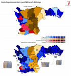
    val-lt-1910-skåne.png
     
    Last edited:
    OGR: local government
  • The Local Government and Divisions of the Republic of America

    Before the founding of our great Republic, the lands along its eastern coast were thirteen British colonies. They rebelled against British rule, formed a confederation to manage shared interests, and eventually merged to become the Republic of America. The Republic's constitution provided for provincial governments to be composed of a governor chosen by the Supreme Governor and serving at his pleasure, and a bicameral legislature mirroring the national one (with the upper houses appointed by the governor rather than elected for life), and turned the old colonies into provinces. Over the nineteenth century, although the population of the Republic multiplied several times, and the interior lands grew almost as prosperous as the old colonies, the provincial boundaries were hardly changed. The Federalist Party saw a useful structure in the system that kept provinces small and coherent in their stronghold, while diluting the Patriot vote in the interior of larger provinces that could easily be won by the Federalists. Add to this the increasing influence of a province's Senators in the selection of appointees for the governorships and national offices within their provinces, and the system was bound to fail. And in the 1880s, with the peak of Federalist dominance and corruption under Donald Cameron and Thomas Platt, it did.

    Although several Treasurers had been from west of the Appalachians, Adlai Stevenson was the first western Federalist to serve in that office. He shared with the Radicals and his colleagues within the western Federalism a belief that the structure had failed, and one of the reforms he set out to make while in power was the reform of local government. The reform plan passed during his term in office was named for him, and is one of his most enduring legacies. Although boundaries have changed, the Stevenson Plan forms the basis of local government in the Republic to this day.

    The Stevenson Plan provides for three layers of government below the national: department, district and township. There were 65 departments when the plan was put into effect - today the number is 71 including the city of New York, which combines the powers of a department, a district and some of those of a town. Powers handled at department level include policing, public education, public transportation and most highways not under the national government.

    Each department has a prefect, appointed by the Supreme Governor with the advice of Cabinet for a single term of six years (but removable before the end of this term). The prefect has exclusive authority over emergency services within the department, and functions as a liaison between the national and local levels of government. This includes stepping in to counteract any sign of corrupt or undemocratic practices on the part of local governments. There is also a general council in each department, which is responsible for approving its budget and local laws. The general council is chosen for a term of three years, one year removed from National Assembly elections. Each district is entitled to at least one general councilman, but can elect several if its population is large enough.

    The districts have changed significantly more in number, but have always numbered in the hundreds. They have power over an additional swath of issues including smaller public roads, public housing, cultural funding and fire and rescue services, most of which are at least partially funded by the national government. Each district has a commissioner and a district council, mirroring the prefect and general council of a department, although the commissioner is usually elected by the council. The council has a set number of members that scales with population, from seven members in the smallest districts to 35 in the largest. The district and township councils are chosen in coordinated local elections held every three years, in the years where ne

    At the most local level is the township, which may refer to itself as a town or borough if it covers a predominantly urban area. The townships number in the thousands, and mostly cover individual towns or survey squares with between a few hundred and a few thousand inhabitants. Townships traditionally have a more limited brief, including local planning, utilities and waste collection - their real power lies in their right to be consulted on changes made by the higher levels, such as the running of schools, post offices, police and public transportation. Each township is governed by a mayor, but the legislative arm varies depending on population. Townships with more than two thousand inhabitants have a council, whose membership scales with population (from five to fifteen), but those with fewer than that may choose whether to have a five-member council or a town meeting which votes directly on local issues and elects a mayor to carry out daily governance in between meetings.

    There are also cities, which combine the powers of the district and township level. Most major urban areas in the Republic are cities, but the title is technically not allowed to be used for those with district governments over them. Cities typically have broader leeway to regulate their own form of government, but the prefect's supervisory powers still apply everywhere except New York, where the National Assembly exercises the same function directly. All cities have a directly elected council of some type, and most have a mayor chosen either by that council or by direct popular vote. The latter can lead to a situation where the mayor is from a different party than controls the council, causing some confusion and greatly reducing the efficiency of the city government.

    When the system was set up, all local government at district and township level was officially nonpartisan. Candidates might, and often did, belong to a political party, but this would not be indicated on the ballot and campaigning on partisan politics was seen as uncouth. This tradition of pragmatism and non-partisanship in local government, which was almost certainly a deliberate goal of the reform, has persisted to this day in many parts of the country, although individual departments may now choose whether to include party affiliations on local election ballots within their boundaries, and most do. Local traditions vary from place to place, but district councils are more likely to have partisan elections than town councils, urban areas more so than rural areas, and the more central regions of the country more so than the peripheral ones. Although both may hold partisan elections, one is far more likely to come across unopposed independents on a town council in Dakota or Altamaha than on a district council in Massachusetts.
     
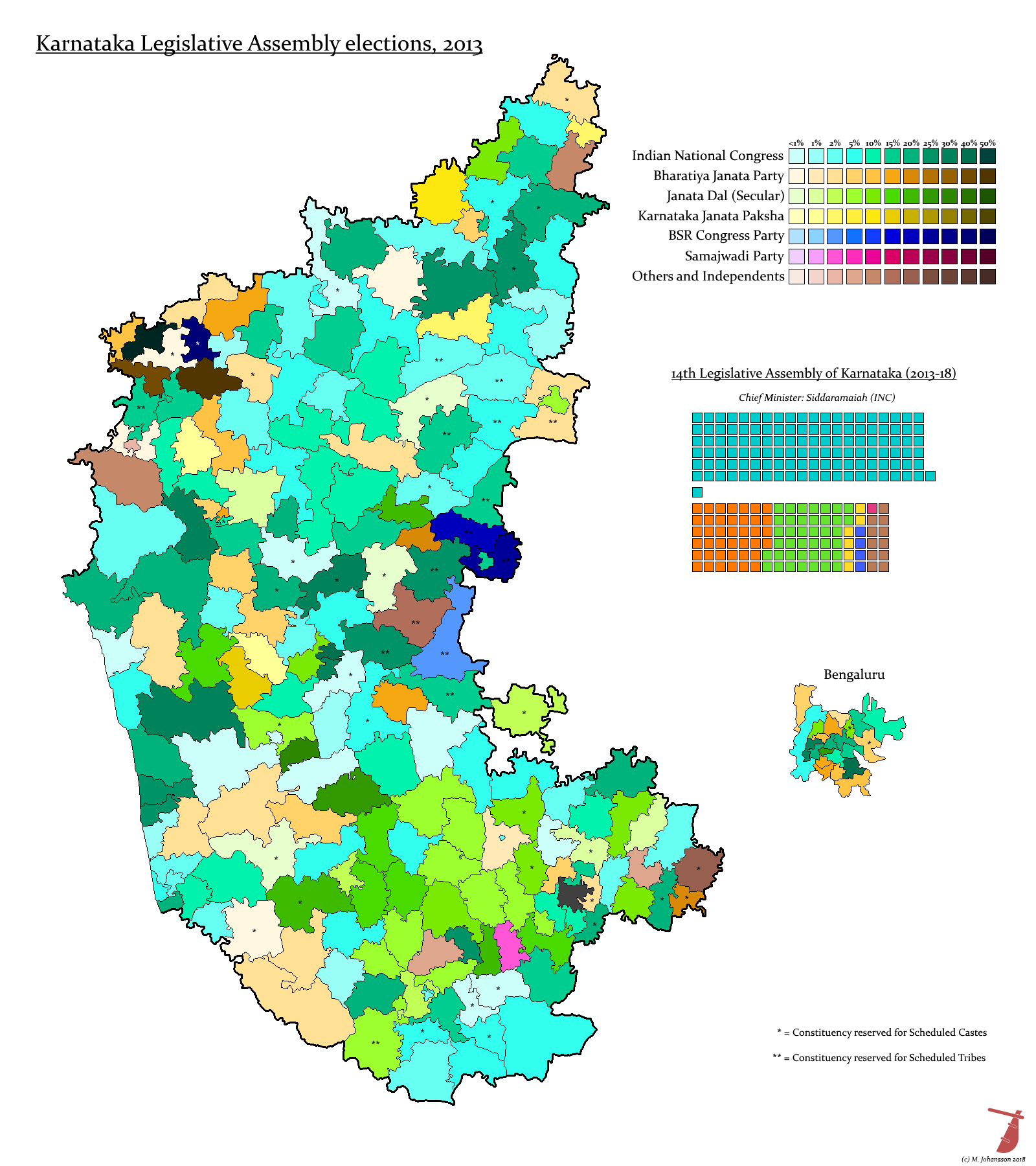
    Karnataka 2013
  • Posting this hereabouts. For the writeup see the DA - thanks to @rmanoj for looking it over.

    karnataka_legislative_assembly_election__2013_by_ajrelectionmaps-dcbhaaz.png
     
    Gujarat 2017
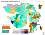
  • Next up is Gujarat, just to really grind the orange shades down.
    It turned out to be slightly (slightly) more interesting than that - I would imagine mainly because Modi wasn't a CM candidate the last time around. Gujarat seems to be a swing state except when he's around, because the BJP won crushing majorities throughout his leadership and then every single Lok Sabha seat in 2014.

    val-in-gujarat-2017.png
     
    Andhra Pradesh/Telangana 2014
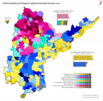
  • DOUBLE HEADER! (they were technically one election, because Telangana only split off just after, although a) everyone basically knew they were electing separate assemblies, and b) while they were synched to the federal elections, these were Indian federal elections, so Telangana was in a phase that voted one week before the phase the rest of Andhra Pradesh was in)

    val-in-andhrapradesh-2014.png
     
    Chhatisgarh 2013
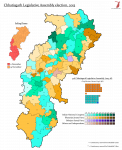
  • This was quicker than I'm frankly comfortable with.

    val-in-chhatisgarh-2013.png

    Also virtually no change in seat possession from either the 2008 or 2003 elections - i.e. all the other ones that have been held since it became a state. I hereby officially proclaim Chhatisgarh the dullest state in India.
     
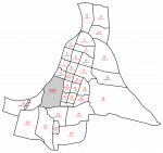
    Calcutta 1923 (wards)
  • An unexpected byproduct of the Indian mapping: the wards of Calcutta set out in the Municipal Act 1923. I don't know when these were replaced, but these boundaries (excepting the Kushita region southeast of the city centre) were the ones used until 1984, when the corporation was extended to cover most of the southern suburbs. By that point the number of wards was 100, turned to 141 by the extension, but in 1923 there were 32. The number was reduced to 31 when Garden Reach was split off as a separate municipality in 1932 and then brought back up to 32 by the bifurcation of Alipur ward later the same year, giving us a ward 22A but no 26.

    I will make some reservations regarding the southwestern boundary, as it was based on "the southern boundary of the land acquired by the Port Commissioners for the Dock extension" and "the southern edge of the line of the old Taratala Road", neither of which is that easy to parse. I was able to figure out most of the colonial-era street names though, so the actual ward boundaries should be fairly authoritative.

    kolkata-wards-1936.png
     
    India 1936 (constituencies)
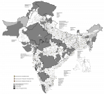
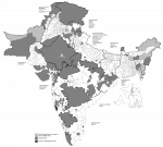
  • Ladies and gentlemen, I give you... INDIA!

    india-1936.png
    india-1936-muslim.png

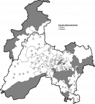
    And of course, the Sikh seats in Punjab and NWFP:

    india-1936-sikh.png

    Assam also had a "Backward" electorate (what modern India calls Scheduled Tribes) whose constituencies covered most of the areas excluded from the general and Muslim rolls, and there were seats for Europeans, Anglo-Indians and/or Indian Christians in most provinces. But as the latter tended to cover the entire province, I haven't bothered to map them. If I ever get full results, I might throw them on as insets.

    I should probably put this up somewhere with a proper writeup, but at the moment, I just want to sit down. (Well, I've been sitting down this whole time, but...)
     
    Last edited:
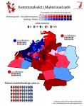
    Malmö 1966
  • Something slightly more modest this time, namely another instalment of Annals from Swedish Electoral Cartography.

    The 1966 local elections were, perhaps, the most significant ones in the history of the country. The general elections of 1964 had seen the standard of non-socialist cooperation raised for the first time, as Bertil Rubin founded Medborgerlig Samling (which, yes, the microparty that @Makemakean keeps going on about is almost certainly named for) as a platform for joint lists, secured the support of Sydsvenskan and a few other Malmö-based groups, and only succeeded in creating a fourth right-wing list in the Malmö-Lund-Helsingborg-Landskrona constituency that won three seats.

    The time was clearly not ripe for a general alliance, but soon enough, the Liberals and Centre began talking, and announced that for the 1966 local elections they would be supporting the creation of joint lists wherever their local parties could agree on such, under the name Mittensamverkan ("Centre Cooperation" or something like that - note the distinction between mitten meaning centrism in general and center as in the Centre Party here). The Conservatives were invited to participate in some cases, in others not, and this resulted in something of a mess - we can comfortably piece together the partisan composition of councils elected in 1966 because the SCB added a section tracking that, but there's no good way to calculate voteshares.

    The 1966 local elections were the first time SR trialled its new approach to journalism. Previously, political interviews had been treated as an opportunity for politicians to speak freely about their policies, and interviewers were generally convivial and forgiving toward their subjects. No more. This time, interviews of party leaders were conducted by the "three Os", Åke Ortmark, Lars Orup and Gustaf Olivecrona, who spared no punches, withheld no embarrassing questions and pressed the leaders for answers. This caught most of the political scene off guard, but none quite as much as Prime Minister Erlander, who was coming up on his twenty-year mark as head of government. Where he had been friendly, masterly and agreeable for as much as he was seen on TV at all, Erlander found himself stumbling at the questions asked of him. Particularly so regarding the housing question, which was getting worse and worse in the major cities especially. His inability to provide a clear solution hurt the Social Democrats, and nowhere more than in the major cities - they lost control of Stockholm, Gothenburg, Uppsala, Jönköping, and a number of other cities.

    In total, the Social Democratic net losses amounted to 3,056. But this is a misleading figure by itself - the country was, of course, midway through a local government reform at the time - the block municipalities were created in 1964, and encouraged to merge at their own pace. A few had done so by these elections, in others the process had yet to start, and others still were partway through the mergers, creating a patchwork map.

    Malmö fell into the latter category, and technically still does so today. It had been placed in a large block covering the municipalities of Oxie, Bunkeflo, Svedala, Bara, Burlöv and parts of Staffanstorp. By 1966, Oxie had finalised merger negotiations and been placed into the first (northern and eastern) constituency for Malmö City Council. Bunkeflo merged in 1970, and from there on negotiations stalled. The other three municipalities were uninterested in joining, and Bara and Svedala would eventually merge (not without resistance on the former's part) while Burlöv remains intact, the second-smallest municipality in Sweden by land area.

    So it was a changing city that went to vote in 1966, and in more ways than one. The harbour shoreline was further out than it had ever been, but not as far as today. The housing estates that dominate the east and south of the city (and from one of which I'm currently writing this) were partway built, and the shift in voting habits partway finished with it. The Social Democrats had ruled the city since 1918, the first election held under universal suffrage, and the cracks were beginning to show even as the shipyards and factories showed record profits and the only underperforming business seemed to be the unemployment offices.

    Malmö was where MBS had been born, and its local Conservative party had been cheering it on, in sharp contrast to their more hardline brothers in Stockholm and elsewhere. They got along swimmingly with the Liberals - if anything, it was Liberal reticence that prevented MBS from properly being implemented in 1964 - and Malmö, as with the other Scanian cities, saw the creation of a broad right-wing unity list called Samling i Malmö ("Malmö Coalition" or something). Well, in Malmö it wasn't quite a perfect union, because there was also a Liberal-Centre unity list under the Mittensamverkan name. Just to make things perfectly confusing. The SCB file notes that both members elected off this list were Centre Party members, which makes them the first such ever elected in Malmö.

    It gets harder to divide the SiM seats, but I've made a completely arbitrary division that's probably no wronger than any other guess - I'll see if I can shake down a membership list sometime.

    Anyway, Malmö was one of few cities where the Social Democrats pointedly did not lose power in 1966. Perhaps because the city was expanding rapidly, perhaps because the industrial crisis was still ten years away. In any case it hardly mattered, because Malmö, like all municipalities outside Stockholm and possibly Gothenburg, used a Proporz system to divide municipal government posts. I mentioned the local Conservatives and Social Democrats were chummy - well, after a spirited campaign aimed at displacing the Social Democrats that failed, the fifteen Conservatives elected to the council went right back to cooperating with them in governing the city. Majoritarian government, too, would be another ten years in the making, although who knows what might have happened if SiM had won another three seats and gotten to govern the city.

    val-1966-malmö.png
     
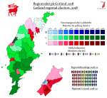
    Gotland 2018
  • And the first result of last Sunday's elections: Gotland 2018.

    The reason for this is, of course, that Gotland doesn't have a county council to count first: or rather, this is the county council. When the order came out to form blocs and merge in 1964, it was decided that there wasn't really any point trying to keep Gotland divided because Visby is in every meaningful sense the central place for the entire island. So the county council and the fourteen old municipalities were subsumed into the Gotland municipality, which changed its name to Region Gotland in 2011. Along with the name change, its powers were expanded to make it fully equivalent to a mainland regional council as well as a local one, which arguably makes it the most powerful local body in the country.

    Politically it's divided between Visby, which votes like a major city (in part because a lot of its inhabitants are transplanted Stockholmers), and the countryside, which is an S/C duopoly with the former stronger in the north and the latter in the south. The Centre boost in this election brought them to new highs in Gotland, as the party succeeded in attracting centre-right liberal Visbyites while also shoring up their base in the rural south. This growth regained them their Riksdag seat, which had been held by the Moderates since 2006, and brought them to parity with the Social Democrats on the council.

    SD are weaker in Gotland than in other parts, probably because no one in the SD leadership understands the dialect, but FI continue to eke out a place for themselves based on support in Visby. Due to the elimination of the council constituencies, they went up to two seats in this election, while KD reclaimed their place on the council for the first time since 2010.

    val-2018-gotland.png
     
    Last edited:
    Back
    Top